Why EM surveys matter in a world of expensive fertiliser
Soil variability often drives yield differences across a paddock. When nitrogen fertiliser is expensive or hard to source, understanding where nutrients are needed most becomes critical. Electromagnetic (EM) induction surveys – sometimes called EM machines – provide a detailed map of soil properties without digging thousands of holes. By measuring the soil’s apparent electrical conductivity, EM surveys reveal differences in moisture, salinity and clay content. This information helps farmers allocate fertiliser and soil amendments precisely, reducing waste and improving returns.
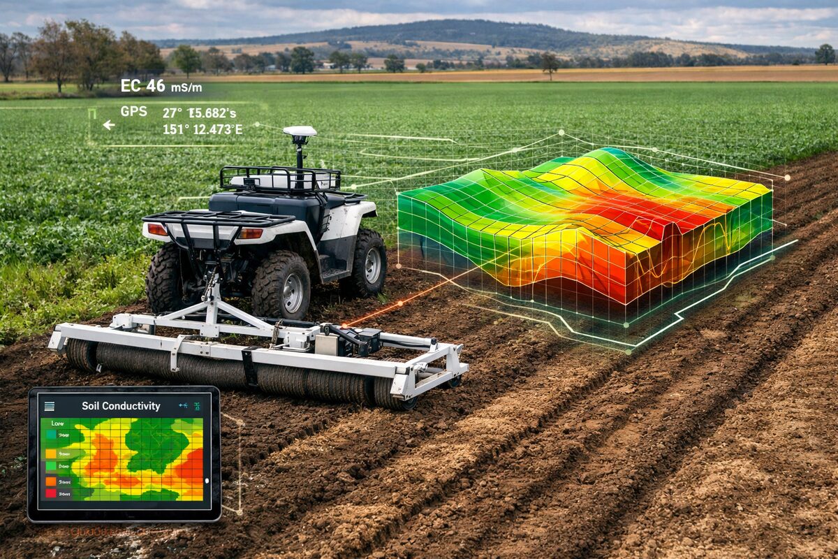
How an EM survey works
Ground-based EM surveys pass a small current through the soil and record the resulting conductivity. The GRDC notes that EM surveys “measure apparent soil electrical conductivity (ECₐ), which is an indirect measure of salinity, but also indicative of soil texture and moisture”[1]. Higher EM readings usually signal more moisture, a higher clay content or elevated salinity. In sandplain or lighter soils the readings are heavily influenced by moisture and the depth of the clayey sub-soil[1]. Most agricultural surveys use dual-EM, which integrates conductivity measurements down to about 50 cm and 1.5 m[1].
An EM unit is typically mounted on a sled or small trailer and towed across the paddock along transects about 36 m apart. A combined EM and radiometric survey can cover roughly 50 hectares per hour and costs around $10-$15 per hectare without interpretation or about $25 per hectare with full ground-truthing[2]. Measurements are taken every few metres, producing a high-resolution map of variability.
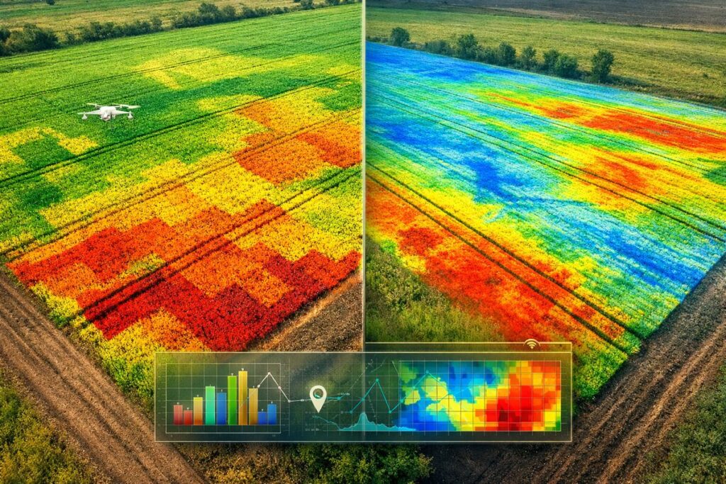
What the maps reveal
Depth to clay and subsoil constraints
EM maps are particularly useful for identifying the depth to a clay layer and other subsoil constraints. The GRDC’s case study on sandplain soils notes that EM data can help determine whether to clay, spade or delve a non-wetting soil. If the clayey sub-soil is deeper than 50 cm, claying is likely the best option; for spading the clay should be within 30 cm of the surface, and for delving within 50 cm[3]. Because clay spreading and amelioration are expensive (ranging from $250 to $1,800 per hectare), using EM to target problem areas is comparatively cheap homework[4].
Soil texture, moisture and salinity
Each EM reading reflects a combination of soil factors. Optisoil explains that EM induction measures the soil’s apparent electrical conductivity, which is influenced by moisture, salinity and clay content[5]. High EM readings generally indicate wetter or more clay-rich areas, while low readings often correspond to sandy or drier soils. When combined with gamma-ray radiometric surveys, which detect natural gamma radiation from isotopes like potassium-40, uranium and thorium[5], the data provide insight into soil mineralogy and texture. Optisoil notes that integrating EM with gamma radiometrics improves soil texture differentiation, helps identify subsoil constraints such as acidity or compaction, and yields more accurate soil variability maps[6].
Combining EM with other data – strengths and cautions
EM surveys are most powerful when combined with other data sources. GRDC emphasises that EM and radiometric surveys should be interpreted together because the equipment does not measure every square metre; instead, software interpolates values between survey lines[7]. Moisture conditions at the time of the survey also influence readings: radiometrics perform best when the soil is dry, while EM needs some moisture for accurate readings[7]. To avoid misinterpretation, surveys are often scheduled when soil moisture is moderate and results are verified with soil cores.
Combining EM maps with NDVI imagery (which shows crop biomass) and soil tests creates a robust picture of a paddock’s variability. Low NDVI zones that also exhibit low EM readings may indicate sandy, nutrient-poor areas; conversely, high NDVI but low EM might signal moisture stress rather than fertility issues. By overlaying these datasets, farmers can tailor fertiliser rates, lime or gypsum applications and soil amelioration strategies with greater confidence.
Takeaway
EM surveys provide a cost-effective and data-rich method for mapping soil variability, especially during periods of high fertiliser prices. By measuring apparent electrical conductivity, EM equipment reveals differences in soil texture, moisture and salinity[1]. The resulting maps help farmers identify subsoil constraints and allocate fertiliser, lime and ameliorants precisely. When combined with gamma radiometric surveys[5] and other data such as NDVI imagery, EM surveys become a powerful tool for precision agriculture and sustainable nutrient management.
References
- [1] [2] [3] [4] [7] Using ground-based EM and radiometrics to map soil amelioration | GroundCover https://groundcover.grdc.com.au/agronomy/soil-and-nutrition/using-ground-based-em-and-radiometrics-to-map-soil-amelioration
- [5] [6] Precision Soil Mapping: Combining EM Induction, Gamma Radiometrics and Machine Learning https://www.optisoil.com.au/news/details/better-soil-decisions-with-em-gamma-and-machine-learning